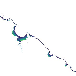
ga_s2ls_intertidal_cyear_3_x124y167_2018--P1Y_final.stac-item
dataset of product ga_s2ls_intertidal_cyear_3
Indexed by odc_admin
,
created
Region
x124y167
for
1st January 2018
Fields 🔗
creation_time
2024-04-02 08:21:12
dataset_maturity
final
eo_gsd
10.0
format
GeoTIFF
id
e23450b6-22f3-4eeb-995d-f9410d7974f8
instrument
ETM_OLI_TIRS_MSI
intertidal_hat
2.98
intertidal_hot
2.38
intertidal_lat
-3.26
intertidal_lot
-2.69
intertidal_offset_high
9.59
intertidal_offset_low
9.14
intertidal_otr
5.07
intertidal_spread
81.26
intertidal_tr
6.24
intertidal_tr_class
macrotidal
label
•
lat
-14.728 to -14.427
lon
127.879 to 128.182
platform
landsat-7,landsat-8,sentinel-2a,sentinel-2b
product_family
intertidal
region_code
x124y167
time
2018-01-01 00:00:00 to 2018-12-31 23:59:59