ga_s2ls_intertidal_cyear_3_x084y144_2020--P1Y_final.stac-item
dataset of product ga_s2ls_intertidal_cyear_3
Indexed by odc_admin
,
created
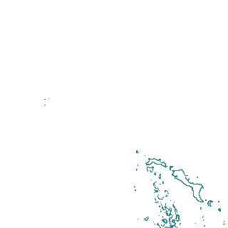
Region
x084y144
for
1st January 2020
Fields 🔗
creation_time
2024-04-01 20:55:21
dataset_maturity
final
eo_gsd
10.0
format
GeoTIFF
id
d2d15788-cb44-4b6e-9008-871e14ced9e8
instrument
ETM_OLI_TIRS_MSI
intertidal_hat
1.55
intertidal_hot
1.28
intertidal_lat
-1.57
intertidal_lot
-0.94
intertidal_offset_high
8.47
intertidal_offset_low
20.15
intertidal_otr
2.22
intertidal_spread
71.38
intertidal_tr
3.12
intertidal_tr_class
mesotidal
label
•
lat
-20.458 to -20.136
lon
115.305 to 115.65
platform
landsat-7,landsat-8,sentinel-2a,sentinel-2b
product_family
intertidal
region_code
x084y144
time
2020-01-01 00:00:00 to 2020-12-31 23:59:59