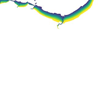
ga_s2ls_intertidal_cyear_3_x097y146_2018--P1Y_final.stac-item
dataset of product ga_s2ls_intertidal_cyear_3
Indexed by odc_admin
,
created
Region
x097y146
for
1st January 2018
Fields 🔗
creation_time
2024-04-02 07:47:23
dataset_maturity
final
eo_gsd
10.0
format
GeoTIFF
id
b7e69d52-2d37-47c8-bffe-e6feb7181120
instrument
ETM_OLI_TIRS_MSI
intertidal_hat
4.37
intertidal_hot
3.37
intertidal_lat
-4.44
intertidal_lot
-2.39
intertidal_offset_high
11.41
intertidal_offset_low
23.2
intertidal_otr
5.76
intertidal_spread
65.4
intertidal_tr
8.81
intertidal_tr_class
macrotidal
label
•
lat
-20.306 to -19.992
lon
119.355 to 119.691
platform
landsat-7,landsat-8,sentinel-2a,sentinel-2b
product_family
intertidal
region_code
x097y146
time
2018-01-01 00:00:00 to 2018-12-31 23:59:59