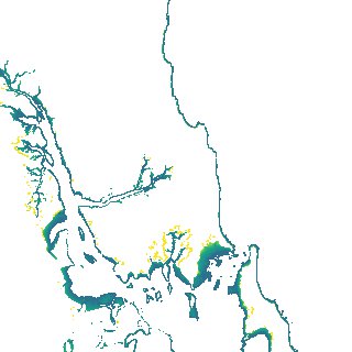
ga_s2ls_intertidal_cyear_3_x198y131_2019--P1Y_final.stac-item
dataset of product ga_s2ls_intertidal_cyear_3
Indexed by odc_admin
,
created
Region
x198y131
for
1st January 2019
Fields 🔗
creation_time
2024-04-02 02:57:55
dataset_maturity
final
eo_gsd
10.0
format
GeoTIFF
id
a8ac1845-d7c1-4c6c-9175-8a827bec0894
instrument
ETM_OLI_TIRS_MSI
intertidal_hat
2.3
intertidal_hot
2.21
intertidal_lat
-2.02
intertidal_lot
-1.28
intertidal_offset_high
2.09
intertidal_offset_low
17.09
intertidal_otr
3.49
intertidal_spread
80.82
intertidal_tr
4.32
intertidal_tr_class
macrotidal
label
•
lat
-23.87 to -23.545
lon
151.074 to 151.435
platform
landsat-7,landsat-8,sentinel-2a,sentinel-2b
product_family
intertidal
region_code
x198y131
time
2019-01-01 00:00:00 to 2019-12-31 23:59:59